There has been a lot going on in ABC. Some of the changes, you may have noticed. Many of them, you may be unaware of. Probably the biggest news has been the creation of a new web site. The new web site has many features that our old site did not have. The most notable is, that members now have a login and password. These have been emailed to you. We can see that about one-in-three members have logged into the site. The use of a login, means that we are able to create members-only web content, and also handle ride registration. Additionally, members can be granted permission to add, edit, or delete web content. And all of this without having to learn any programming languages. Our goal is to get as many people as possible involved in the development and maintenance of the web site.
This means that chapter and ride leaders can make sure information on the web is accurate and timely. Speaking of timely, the new web site offers a calendar. Members can post rides and events on the calendar. Of course, that raises the question, "What constitutes a club ride?" From an insurance point of view, a club ride must be at least three (3) members. From the club's point of view, a club ride must have a ride leader. That raises another question, "Who can be a ride leader?" At present, the club has no clearly established criteria. But, I believe there are several things ride participants would hope for, and expect. Of course, with the new web site, some of these expectations are changing. In the club's future, I believe a ride leader must:
-Know how to add/update/delete events on the club's web site calendar.
-Sign-in riders at the start of the ride getting waiver signatures and emergency contact information.
-Be prepared to file an incident report in the event of an accident.
-Be able to demonstrate a good understanding of the rules of the road and basic riding techniques.
Of course, making sure that everyone has a good time, also depends on, providing route information, looking after each other, and many other things. And that brings us back to the original question, "What constitutes a club ride?" I think a club ride is an opportunity to enjoy cycling in a social environment. Any of us can choose to ride by ourselves any time. But, we all recognize that riding with a group has lots of appeal and benefits. As a club, we offer tangible benefits, such as insurance coverage, a newsletter, a web site, etc. But, we also offer intangible benfits, such as the opportunity to find riding companions who are well suited to our distance, pace, and style.
While the typical Saturday or Sunday club ride is a great thing, I also believe the ad hoc rides, which a few friends can put together with only a couple of day's notice, are part of being an active and social cyclist. In order to give members the maximum value for their membership, I would like to see these rides treated as club rides too. In my vision of the club's future, with a few phone calls, emails, text messages, or by using the forums on the club's website, a few members decide to take a ride. One of the members (having the qualifications above) takes the role of ride leader and puts the event on the club's calendar. The ride leader prints out a sign-in sheet and gets it filled in by the riders. Everybody goes on the ride and has a good time. In this scenario, the members have benefitted from the tangible club benefit of insurance, because the club has provided an environment, which promotes getting out on our bikes. Maybe this ad-hoc ride becomes a regular event, maybe not, but either way, it is a club ride.
Of course, as a club officer, I want to know how many people are showing up for rides. We all like feedback. Doesn't it give you a sense of accomplishment, when you add up your miles for the week? Wouldn't it give you a sense of pride in your club, to be able to brag about how many great club rides there were last year? How many lives have been enriched by the club? How can we gauge the health of the club if we can't measure it's temperature? Nobody want's to turn this simple question into a beauracratic record keeping nightmare. However, our new website provides us with the opportuinty to do this kind of thing with just a few mouse clicks. With today's technology, it's not a question of "if" we can do something. It is a question of whether we care enough to do it at all! If, as a club, we want to grow, thrive, ride, promote cycling, then we must come together and make things happen. Without followers, leadership is nothing! Club members have to make known their hopes and desires for the club. But, at the same time, saying, "The club ought to...." doesn't work, unless there are members who are willing to DO those things that the club should do. The club depends on volunteers. Be proud of your club and ask what you can do to make the club even better.
Monday, September 6, 2010
Monday, August 30, 2010
Anthem Sprint Try-athlon
It was just a month ago today, I headed out for my first training run after concluding that I should "try" a sprint triathlon. If I'd thought about it sooner, I'd have liked to start training earlier. It wasn't until after I decided that I wanted to "try" this, that I actually looked at the calendar. As a life-long cyclist, the 20K ride wouldn't be a problem, but I've never been a runner, and summer swim team is 40 years behind me. The 5K run would be the real challenge for me. The 400 meter swim will probably not be pretty, but I think I can get through it.
My normal running route for the past week or two, has been a 3.14 mile loop (5K). That route goes from my front door and loops around the Community Center. I've been arriving home from this run pretty much spent. Today, I thought I would "try" to bring two pieces together for the first time. My plan was to run up to the Community Center and "try" to swim 200 to 400 meters, depending on how it felt when combined with the running. Then I would finish with the run home. Since this would be a first for me, I though I would shorten the run by making a bee-line for the Community Center and then back via the same route. That would shave a mile or so off my "standard" loop. However, about when I got within sight of the Community Center, I realized that I had forgotten my ID and wouldn't be able to "try"combining swimming with running. At that point, it was a relatively easy decision to convert my run back to my normal distance. I was feeling pretty good as I turned onto my street. So, on a whim, I though, "I should 'try' hopping on the bike and riding back up to the Community Center for a swim." So I would "try" my first transition at my own home.... Grab my ID, change shoes, put on my helmet, gloves, get a drink, grab my bike out of the garage, and go. As near as I can tell, that took about 4 minutes, but I felt pretty good getting on the bike. I've been doing all my running in the mornings, but now it was around 6:00 PM and although the sun was setting, the temperature was still nearly 100 degrees. The evaporate cooling effect at bike-speed was refreshing, so, I opted for slightly more riding than the bee-line route back to the Community Center. But the distance wasn't really the point. It was novel for me to do ANYTHING after running 5K, besides flopping down on a patio chair until the sweating and the panting subsided enough for a shower. So, after only about 8 minutes on the bike, I arrived at the Community Center and transitioned again into the pool. I paused for a breather at 250 meters, only to hear that the pool was closing. (Who knew, 6:30 on Sunday? Well, not me!). ...out of the water and back on the bike, I rode home. In the end, within just over an hour, I ran 5K, biked a total of 3.5 miles, and swam 250 meters. So, I try-ed!
My normal running route for the past week or two, has been a 3.14 mile loop (5K). That route goes from my front door and loops around the Community Center. I've been arriving home from this run pretty much spent. Today, I thought I would "try" to bring two pieces together for the first time. My plan was to run up to the Community Center and "try" to swim 200 to 400 meters, depending on how it felt when combined with the running. Then I would finish with the run home. Since this would be a first for me, I though I would shorten the run by making a bee-line for the Community Center and then back via the same route. That would shave a mile or so off my "standard" loop. However, about when I got within sight of the Community Center, I realized that I had forgotten my ID and wouldn't be able to "try"combining swimming with running. At that point, it was a relatively easy decision to convert my run back to my normal distance. I was feeling pretty good as I turned onto my street. So, on a whim, I though, "I should 'try' hopping on the bike and riding back up to the Community Center for a swim." So I would "try" my first transition at my own home.... Grab my ID, change shoes, put on my helmet, gloves, get a drink, grab my bike out of the garage, and go. As near as I can tell, that took about 4 minutes, but I felt pretty good getting on the bike. I've been doing all my running in the mornings, but now it was around 6:00 PM and although the sun was setting, the temperature was still nearly 100 degrees. The evaporate cooling effect at bike-speed was refreshing, so, I opted for slightly more riding than the bee-line route back to the Community Center. But the distance wasn't really the point. It was novel for me to do ANYTHING after running 5K, besides flopping down on a patio chair until the sweating and the panting subsided enough for a shower. So, after only about 8 minutes on the bike, I arrived at the Community Center and transitioned again into the pool. I paused for a breather at 250 meters, only to hear that the pool was closing. (Who knew, 6:30 on Sunday? Well, not me!). ...out of the water and back on the bike, I rode home. In the end, within just over an hour, I ran 5K, biked a total of 3.5 miles, and swam 250 meters. So, I try-ed!
email to the cross country running coaches a Boulder Creek High School
I live in Anthem and am both a runner and a cyclist. Now that school is back in session, I've noticed something that I would like to bring to your attention. In the morning, I often see school atheletes running in the bike lanes facing traffic, particularly going south along Gavilan Peak Parkway between Anthem Way and Memorial Drive. Many of us have been taught to walk facing traffic. However, this advice only applies in cases where there is no sidewalk. This is specifically addressed by Arizona law (ARS 28-796): "If sidewalks are provided a pedestrian shall not walk along and on an adjacent roadway". Given that I cannot think of any roadway in Anthem that doesn't have an adjacent sidewalk, I contend that nowhere in Anthem is it proper to run in the roadway.
I'd be happy to discuss with you the several reasons why I believe that if runners are going to violate this law and run in the roadway, it would be safer for them to run in the direction of the traffic. However, I doubt that the school wants to endorse illegal behavior. I think the most prudent thing, is to instruct runners to stay out of the road except while crossing at designated crosswalks. In defense of the runners, I have noticed that they do seem to pay particular attention to crossing Gavilan Peak Parkway using the traffic signals and crosswalks at Memorial Drive. This is very good!
I think the best strategy for all concerned is to look for running routes which capitalize upon the miles of off-street walks and trails in Anthem. I have spent many hours with Google Earth and other mapping software, studying the network of trails throughout Anthem and I have devised many routes of varying distances and surfaces (concrete, decomposed granite, dirt, etc). I would be happy to work with you and your team members to design routes which meet their training needs while discouraging the use of the roadway.
Unfortunately, many if not most of the adult runners that I see, are also misbehaving exactly as I have described. What I would like to see is a whole new generation of runners that understand why it is so dangerous for them to run in the roadway facing traffic. While we are at it, it might be good to make sure that if any of the students are also cyclists, they should understand that they DO belong in the roadway and NOT on the sidewalks. Traffic laws are for everyone's protection. Obeying them is in everyone's best interests. School is a good place to reinforce this.
Please feel free to call me at 623-326-3455 if I can help.
Thanks for your time,
Saturday, August 14, 2010
Anthem Trails email sent to HOA
I believe that the location of the makeshift bike course, pictured in the August 5, 2010 edition of "In & Out", is just down the street from my house. While it is easy for the HOA to point the finger at the residents, I believe they also bear a certain responsibility. Looking at the trail signs posted around the neighborhood, it is clear that many of the trails which were planned, were never built. In fact, a trail was planned for the desecrated area in the picture. Had the planned trail been built, vandalism in this area would not have occurred. The kids who built this bike park would not have felt they were in an abandoned parcel of the community. They picked that area precisely because it didn't have a trail going through it. It is a place where the sidewalk literally ends.
It appears that many people, including some of the-powers-that-be, feel that environmental regulations prevent improvement in the washes. It becomes easy to say, "We can't put a sidewalk through a wash! That's a protected area." And yet, the maintenance crews can dump loads of cholla, or piles of boulders in washes to discourage traffic through them. You can't have it both ways! I believe that properly engineered accommodations, such as trails and culverts can be built, particularly in cases where doing so is part of repairing existing damage to the environment or to protecting it from future damage. Many examples of such accommodations already exist within the community. Clearly, there are administrative hurdles to such plans. Does that mean we shouldn't investigate them? Of course we should. We should operate from the premise that rules will not prevent us from protecting our environment.
The improvised bike park is not an isolated situation. A casual observer can recognize many opportunities to improve the trail system here in Anthem: foot paths, made by people going where they want to go, where there is no accommodations to limit their impact on the environment. Rather than simply threatening to enforce rules, the HOA should take stock, and determine what can be done to accommodate where people want to go and protect the environment. Why are so many crosswalks un-marked? Why isn't Memorial Drive striped with bike lanes? How come it's so difficult to ride a bike from the paved multi-use trails to the on-street bike lanes, without encountering a curb? I believe that few Anthem residents are aware of the Maricopa Trail. The Maricopa Trail is planned to circumnavigate the county, linking parks and recreation areas throughout the county, via a multi-use (hiking, biking, and equestrian) trail. An important segment of this trail lies within Anthem, and yet miles of barbed-wire fence and threatening signs hide this gem. The Maricopa Trail should be a featureof the community, not something we fence ourselves away from! Anthem has miles of beautiful trails and bike lanes. But, it could be even better. It could be world-class. Such distinction would not only be good for the environment, but good for property values. The active lifestyle promoted in the brochures, could be more than just marketing hype.
The community enhancement funds were clearly intended to address such issues. Let's build a list of problem areas around the community and prioritize them. We can work with the regulating bodies to get permits to empower us to protect our open spaces and to enhance opportunities for residents to enjoy these areas responsibly. But the residents cannot possibly do this without the leadership and support of the-powers-that-be.
Friday, March 12, 2010
Riding to The Great Bike Chase
The Great Bike Chase
I was wondering what it would be like to ride to this event from the North Valley. It looks like it could be a cool route. Starting from the Park and Ride in Anthem, head down Gavilan Peak Parkway to Tramonto and then take the North Valley/Norterra Parkway all the way to Pinnacle Peak. Some zigging and zagging around Rose Garden and 15th Ave gets you down to Union Hills. So far, the route has been almost entirely on bike lanes. Just east of 7th Avenue, it is possible to pickup the Multi-use path along the Cave Creek Wash. There are two awkward bits on this trail, but they only amount to 3/10 of a mile out of the 8 miles of paved trails to the Arizona Canal near Dunlap Avenue. Another bit of neighborhood wiggling puts you on 23rd Avenue for a few more miles of bike lane before cutting over to the light-rail station on 19th Avenue just south of Bethany Home. Out of the 29 miles of cycling, around 28 of them have been on a designated bike lane or paved multi-use trail.
Buy an all-day rail pass and board the light-rail with your bike for the last 6 miles to Hance Park at Central Avenue and I-10. You can participate in the event or re-board the light rail and continue on to destinations such as Pueblo Grande at 44th Street and Washington, Papago Park, or cross the river to Tempe and check out the Bike Cellar. Your return trip can be as simple as riding the light-rail back to the north end of the line and retracing the route, or can include a ride along the Grand Canal Path.
Would you think you could go from Anthem to Tempe and back with your bike and it would only cost you 58 miles of riding and $2.50 light-rail fare?
My most minimalist toolbag
These are my current choices


Crank Brothers Speed Lever
Innovation Ultraflate Plus
Swiss Tech Micro-Plus
Ascente Bare Bones Mini-Tool
Performance tube repair kit
Spare Tube powdered and bagged


Tuesday, March 2, 2010
What is the definition of a bicycle?
I read

Based on the revised definition, I can fairly easily imagine contrivances which would technically fit the definition of a bicycle, but which I would think had no business being in traffic.
with interest, particularly, the section which proposes refinement of the definition of a bicycle:
6. "Bicycle" means a device, including a racing wheelchair,
that is propelled by human power and on which a person may ride and that has
either:
(a) Two tandem wheels, either of which is more than sixteen inches
in diameter, except that the wheels
may be smaller if the bicycle is foldable.
(b) Three wheels in
contact with the ground, any of which is more than sixteen inches in diameter.
I found the proposed revision troubling. While in the past, I have accepted the 16-inch wheel rule as central to the definition of a bicycle, the proposed change now has me even questioning that. Since parts A and B are the definition of a bicycle, using "bicycle" as part of the proposed revision to part B is semantically problematic. By my read of the revised definition, since the handlebar folds down,the device below could count as a bicycle.
Bike Friday and other similar travel bicycles typically have a 20" wheel, so I'm not sure exactly what the concern is.
Personally, I think that a rotary, human powered, propulsion mechanism is central to the definition of a bicycle. Pushing off with a foot, like with a skateboard, scooter or rollerblades doen't fit this definition but a racing wheelchair and a handcycle would. And if we are going to include trikes as part of bikes, why not quad-wheeled devices?

Based on the revised definition, I can fairly easily imagine contrivances which would technically fit the definition of a bicycle, but which I would think had no business being in traffic.
Thursday, February 25, 2010
Adopt A Street: The Arizona Bicycle Club, Past, Present and Future

ABC participates in Phoenix's "Adopt a Street" program. Our designated roadway is Maryland Avenue from 20th Steet to 12th Street. Of course, many club members know that Granada Park is at 20th Street and Maryland Avenue. What you might not have thought about is the subtle irony that a car can't drive down Maryland Avenue from Granada Park to 12th Street... but a bicycle can! There is this "thing" in the way, it's called the Piestawa Freeway or SR-51. A bicycle can go under the Freeway through a bicycle/pedestrian underpass, but a car has to go a half-mile south to Bethany Home Road to get to the other side of the Freeway.

Looking at the Maricopa Association of Governments Bikeways Map, it is hard not to notice that within a few miles of Granada Park, there are numerous roadway underpasses along the Arizona Canal path. There are three bike/pedestrian bridges associated with the Freeway in the Dreamy Draw area and many more to the north. And, there are multiple underpasses allowing cyclists and pedesrians to cross under the Freeway.

When I moved to the Valley in '92, the Squaw Peak Parkway pretty much ended at Dreamy Draw and dumped traffic onto surface streets. A few years later, The Freeway pushed north to Shea, then to Union Hills Drive, and finally, all the way to the 101 loop. So, much of the design and construction work for the majority of these heavily used bicycle and pedestrian accomodations, which many people now seem to take for granted, was already completed before I even got to Arizona. But now, looking back roughly two decades, one thing is clear. This didn't happen by accident! The Arizona Bicycle Club played an important role in insuring that development in the area did not ignore the needs of area bicyclists.

Founded by Eugene and Sylvia Berlatsky in 1964, ABC has served cyclists in the Phoenix Metro area and across Arizona. ABC has grown over the years into a large and robust organization of over 400 members. ABC is a club affiliate of the League of American Bicyclists (LAB). For over 125 years, LAB has been the premier national membership organization for bicyclists, and serves as a strong voice for cyclists' rights and effective education so bicyclists can share the roads and paths of this nation with safety and confidence. Gene and other club members were instrumental in the establishment of the Phoenix Sonoran Bikeway which connects South Mountain Park with Carefree Highway.

Erected in 2005, the Eugene Berlatsky Bicycle and Pedestrian Bridge on Maryland Avenue, crosses I-17. No other east-west road in Phoenix has a dedicated bicycle and pedestrian accomodation across BOTH I-17 and SR-51 freeways.

In February 2010, ADOT and FHWA hosted public scoping meetings as an opportunity for community members to participate in the scoping process. Scoping is the first step in the stucy process and is intended to inform and involve the public agencies, and special interst groups. The public scoping meetings marked the beginning of ADOT's public outreach program that will continue throughout the study. Public comments regarding the I-17 Study are currently being accepted and can be submitted by using the Public Meeting Comment Form.
Inspired that one person, can make a difference, I attended one of these meetings. What would Gene do?
Saturday, February 20, 2010
Wickenburg Overnighter 2010
Have I gotten spoiled by Arizona weather? I know that even in Phoenix, it is sometimes possible to get caught in a shower on a ride, and so, I'll throw on my Gore-Tex if it looks like it might rain. Normally, I don't like to start riding when it already IS raining. But we've committed to doing this ride. Several riders bailed at the start, but not all, so off we ride. The first few miles just seemed like a bad idea getting wetter.
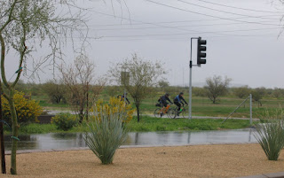
And yet, a few miles before Lake Pleasant with only about 6 miles into the ride, the rain had pretty much abated. Geographically, we crossed the barely noticable New River Wash. With all the rain we've had, it seems like it should have water in it, but the roadway seemed wetter than the wash. We were prepared to shuttle bikes around the construction zone near Lake Pleasant. Even though the construction zone is posted as 3.5 miles long, our reconnaissance had concluded that the areas in question were MUCH shorter. As it turned out, traffic on the outbound leg was light and so the construction zone was a complete non-issue. Our group made the decent into the depths of the Agua Fria river valley. Just upstream, the New Waddell Dam holds back Lake Pleasant but downstream, it looks pretty much like the desert of Marty Robbins' day. At around 1500 feet, this is the lowest elevation we'll see.
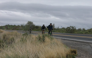
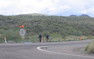
Coming up out of the valley represents a fairly demanding 6 miles of climbing. In another 10 miles we hit the highest point of the ride at around 2000 feet and then begin descending into the Hassyampa Valley and turning north and upstream on Grand Ave (US60). Last year's construction on US60 coming into Wickenburg is now completed but we were a bit disappointed by the striping. Bath, rinse clothes, happy hour, dinner, sleep, breakfast, ride... The return leg was almost completely rainless and almost windless but overcast and cooler than it should be.


And yet, a few miles before Lake Pleasant with only about 6 miles into the ride, the rain had pretty much abated. Geographically, we crossed the barely noticable New River Wash. With all the rain we've had, it seems like it should have water in it, but the roadway seemed wetter than the wash. We were prepared to shuttle bikes around the construction zone near Lake Pleasant. Even though the construction zone is posted as 3.5 miles long, our reconnaissance had concluded that the areas in question were MUCH shorter. As it turned out, traffic on the outbound leg was light and so the construction zone was a complete non-issue. Our group made the decent into the depths of the Agua Fria river valley. Just upstream, the New Waddell Dam holds back Lake Pleasant but downstream, it looks pretty much like the desert of Marty Robbins' day. At around 1500 feet, this is the lowest elevation we'll see.

Coming up out of the valley represents a fairly demanding 6 miles of climbing. In another 10 miles we hit the highest point of the ride at around 2000 feet and then begin descending into the Hassyampa Valley and turning north and upstream on Grand Ave (US60). Last year's construction on US60 coming into Wickenburg is now completed but we were a bit disappointed by the striping. Bath, rinse clothes, happy hour, dinner, sleep, breakfast, ride... The return leg was almost completely rainless and almost windless but overcast and cooler than it should be.

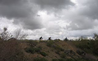
I like to say, "It's difficult to justify spending a lot of money on good rain gear when you live in Phoenix, but it's impossible to test it." Well, this trip proved me wrong. I still don't know how to keep my feet warm and dry in the rain, but the rest of me fared well enough.


Thanks to everyone who made this happen. You know who you are.
I found this great picture using Google Earth. While riding through the area, you get a sense that it looks like this, but pictures taken from the road don't quite reflect it like this picture does. US60 is in the corner of the image, looking upstream toward Wickenburg. Even in the drizzle, it was beautiful. I've done this ride with heat and wind, but this is the first time I've done this ride in the rain and I'll bet money it won't rain on this ride next year!
Saturday, January 30, 2010
Fast Eddies for Breakfast
Breakfast ride starting at Via Linda and Mountain Vieiw in Scottsdale to Fast Eddies 3422 W Glendale Ave, Phoenix.

Crossing over I-17 on the Gene Berlatsky Bridge

Through the Dreamy Draw on the multi-use path.

For full trip details, click on title.

Crossing over I-17 on the Gene Berlatsky Bridge

Through the Dreamy Draw on the multi-use path.

For full trip details, click on title.
Subscribe to:
Posts (Atom)